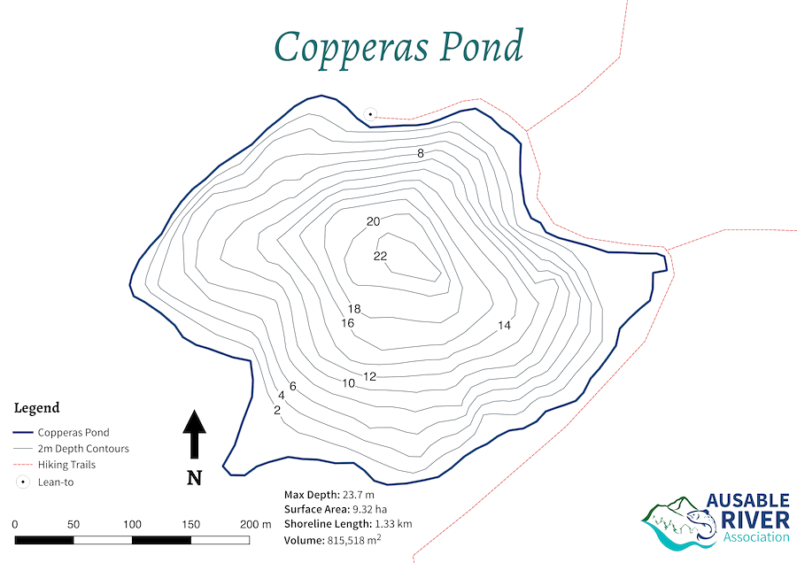
Copperas Pond
Copperas Pond is a small deep pond located 0.5 miles from Route 86 in the Sentinel Mountain Wilderness. It is a popular destination for hikers due to the short distance to the pond and the presence of a lean-to on the north shore. It is one of few lakes within the watershed to hold Lake Trout. The Ausable Freshwater Center (AFC) started monitoring the lake in 2016 so that we have baseline data to help us understand how climate change may be impacting Lake Trout.
Bathymetric Map of Copperas Pond

You can download a PDF version of this map here.
Most Recent Monitoring Data

As of July 29th, 2016 Copperas Pond was thermally stratified with the surface waters slightly higher than 70oF. Most of the water column was well oxygenated with a deep water peak occurring at around 20 feet. The bottom waters have reduced oxygen levels but a good portion of the water column remains both cool and well oxygenated enough for lake trout.